In the digital era, technology has reached impressive heights, transforming the way we live, work, and navigate. One of the most significant advances that has left an indelible mark on our daily lives is the Global Positioning System, better known as GPS. This technology has revolutionized the way we navigate the world and has had a profound impact on various aspects of modern society.
What is GPS and How Does It Work?
GPS is a satellite navigation system that allows for the precise determination of the location of an object or person anywhere on the planet. The system operates through a network of satellites orbiting the Earth. Currently, the GPS system consists of approximately 30 operational satellites constantly transmitting radio signals. GPS receivers in devices such as smartphones, cars, or watches capture these signals and calculate the exact location of the receiver through a process called trilateration.
Importance in Modern Life
The influence of GPS on modern life is undeniable. It has far exceeded its original navigation function and is now integrated into a multitude of devices and services we use daily. Here are some areas where GPS has made an indelible mark:
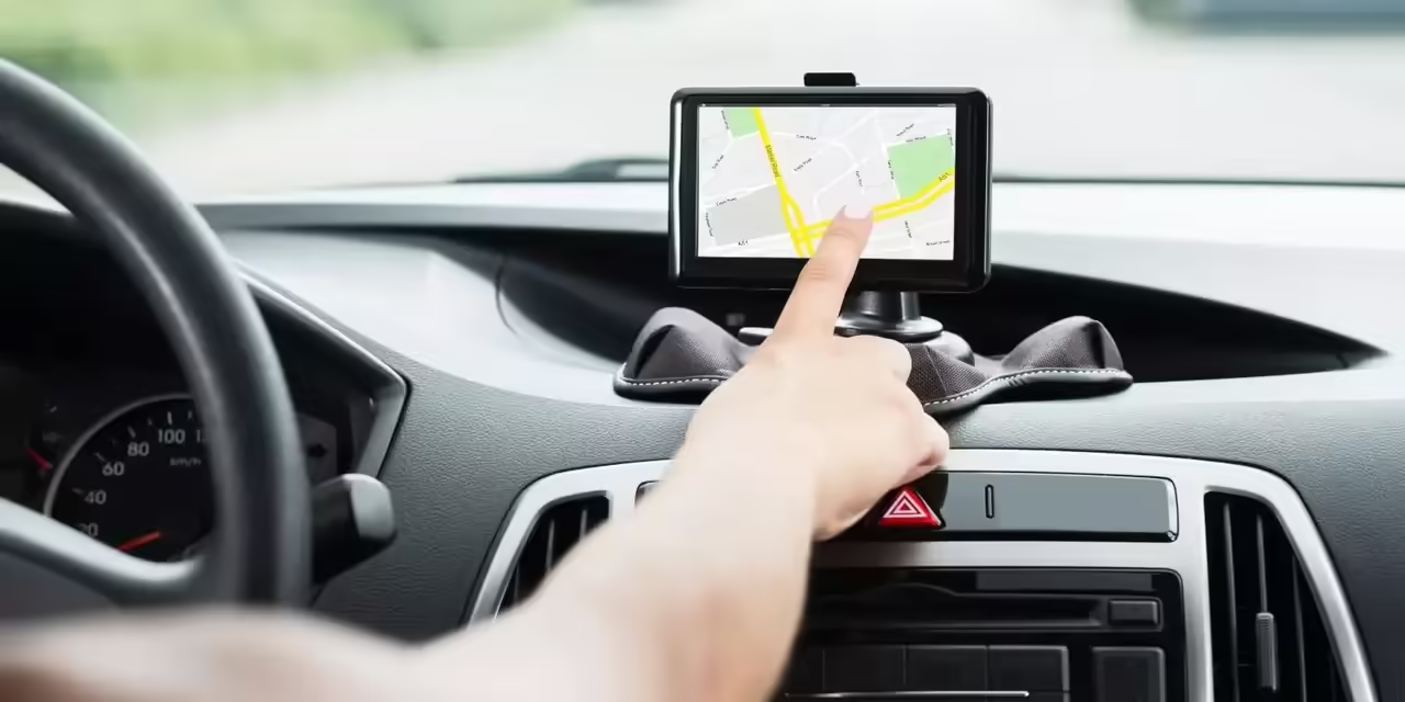
Personal and Vehicle Navigation: GPS has transformed the way we move around the world. From simple step-by-step guidance on mobile phones to integrated navigation in vehicles, GPS has made getting lost virtually a thing of the past.
Safety and Emergencies: In emergency situations, GPS plays a crucial role by enabling rapid and accurate location of people or vehicles. This has significantly improved responsiveness in critical situations, such as traffic accidents or natural disasters.
Commercial Applications: In the commercial sector, GPS has driven a revolution in logistics and fleet management. Transportation and delivery companies use GPS to optimize routes, improve efficiency, and provide faster and more accurate service.
Wearable Technology: Smartwatches and other wearable devices use GPS to offer fitness tracking features, allowing users to record exercise routes, calculate distances, and monitor their progress.
Exploration and Tourism: In the tourism and exploration industry, GPS has facilitated route planning, location of points of interest, and the creation of more enriching experiences for travelers.
Challenges and the Future of GPS
Although GPS has been a technological revolution, it is not without challenges. Total dependence on satellite signals can lead to accuracy issues in dense urban areas or environments with natural obstacles. However, continuous improvements in technology, such as the implementation of Augmented Positioning Systems (A-GPS), are addressing these issues.
In the future, GPS will continue to evolve. The next generation of satellite navigation systems is expected to offer greater accuracy and coverage, enabling new applications and improvements in areas such as augmented reality, autonomous driving, and the Internet of Things (IoT).
Origins of GPS: From the Cold War to the Present
The Global Positioning System (GPS) has evolved from its humble origins in the Cold War to become an omnipresent and fundamental tool in the daily life of modern society. Its history is intertwined with the political and military context of the second half of the 20th century, and its development has been driven by strategic necessity and technological innovation.
Historical Context: The Cold War
The emergence of GPS is closely linked to the Cold War, a period of ideological and military tension between the United States and the Soviet Union. In the 1950s and 1960s, the need for an accurate navigation system for the U.S. military became imperative. Satellite navigation was envisioned as a strategic solution to improve accuracy in locating targets and troops worldwide.
Transit and Timation: The Early Steps
In 1960, the TRANSIT satellite program marked the first serious attempt to use satellites for navigation. Developed by the U.S. Navy, TRANSIT allowed submarines to launch a signal received by satellites to determine the submarine’s position. However, this system had limitations in terms of precision and availability.
At the same time, the Timation project, led by the U.S. Air Force, explored the possibility of using atomic clocks on satellites to measure signal travel time and calculate the position of receivers on Earth.
Navstar GPS: A Global Integrated System
The idea of a global satellite navigation system began to take shape with the development of the Navstar GPS program in the early 1970s. The U.S. Department of Defense led the project, with the first experimental satellite launched in 1978.
The GPS system originally consisted of a constellation of 24 satellites designed to provide global coverage and ensure the continuous availability of navigation signals. The first complete block of Navstar GPS satellites was launched in 1993, and since then, the system has experienced constant improvements in terms of accuracy and performance.
Civil and Commercial Development
Although GPS was conceived as a military system, its utility for civilian and commercial applications became apparent quickly. By the late 1980s, the U.S. government allowed civilian access to GPS signals, leading to the emergence of a wide range of applications in areas such as vehicle navigation, civil aviation, agriculture, and surveying, among others.
GPS Today
Today, GPS has far surpassed its military origins and has become a pillar of modern life. The technology has been integrated into everyday devices such as smartphones, cars, watches, and cameras, transforming the way we move and interact with our surroundings.
Furthermore, GPS continues to evolve with ongoing improvements in accuracy and capability. The development of additional satellite navigation systems, such as the Russian GLONASS and the European Galileo, has contributed to creating a more robust and redundant global navigation environment.
The Birth of the NAVSTAR GPS System: A Crucial Step in Satellite Navigation History
The genesis of the Global Positioning System (GPS) dates back to the 1970s when the United States Department of Defense launched the first NAVSTAR satellite, marking the beginning of a revolution in global navigation and location.
The Initial Vision: A New Era of Navigation
The need for a global and accurate navigation system was identified by the United States Department of Defense in the 1960s. A system was envisioned that would allow the military to precisely determine the location of troops and targets anywhere in the world. This vision led to the development of the NAVSTAR GPS program (Navigation System with Timing and Ranging), with collaboration from the U.S. Air Force, the Navy, and the Aerospace Corporation.
The First NAVSTAR Satellite: Launch and Operation
On February 22, 1978, the U.S. Air Force launched the first NAVSTAR satellite from Cape Canaveral Air Force Station. This experimental satellite marked the official beginning of the system and was designed to test the feasibility of satellite navigation.
The satellite, named NAVSTAR 1, carried a payload of extremely precise atomic clocks and time measurement equipment. The key to determining the position lay in the precise synchronization of the clocks on board the satellite with clocks on Earth.
After launch, NAVSTAR 1 commenced operations and transmitted signals that allowed receivers on Earth to calculate their position through the travel time of signals from the satellite. Although this first satellite had limitations in terms of precision and capacity, it laid the foundation for the development of a larger and more functional satellite constellation.
The NAVSTAR GPS Constellation: Full Deployment
Throughout the 1980s, the NAVSTAR GPS program continued with the launch of additional satellites. The satellite constellation was designed to provide global coverage and ensure constant availability of navigation signals anywhere in the world.
The full deployment of the 24-satellite NAVSTAR GPS constellation took place in the early 1990s. With this operational constellation, the system was able to offer significantly improved precision and global coverage without interruptions.
Civil Access and GPS Expansion
As the NAVSTAR GPS constellation reached its full capacity, the U.S. government made the strategic decision to allow civilian access to GPS signals. This opened the doors to a wide range of civilian applications, from personal navigation to agriculture and civil aviation. Civil access led to rapid growth in the use and dependence on GPS in various sectors of society.
Legacy and Continuous Evolution
The launch of the first NAVSTAR satellite marked a milestone in the history of satellite navigation and laid the groundwork for the technological revolution that would follow. Over the decades, GPS has evolved, improving its accuracy and capability over time. Additionally, international cooperation has led to the development of additional satellite navigation systems, creating a more robust and redundant global navigation environment.
GPS in Mobile Devices: A Transformation in How We Navigate
The incorporation of the Global Positioning System (GPS) into mobile devices has brought about a radical transformation in how we move and navigate in our daily lives. From the introduction of the first smartphones to the present day, GPS in mobile devices has changed the dynamics of personal navigation, route planning, and interaction with the environment in ways that were previously unimaginable.
Instant Personal Navigation: Before the integration of GPS into mobile devices, route planning and personal navigation required consulting printed maps or using independent navigation systems in cars. With the advent of smartphones, location information became instant and accessible to everyone. Map applications like Google Maps and Apple Maps provided users with the ability to get precise directions, visualize interactive maps, and discover points of interest in real-time.
End of the Fear of Getting Lost: GPS in mobile devices eliminated the fear of getting lost in unfamiliar places. There was no longer a need to rely on intuition or ask passersby for directions. Smartphones became personal guides, indicating step-by-step directions and automatically recalculating routes in case of deviation.
Impact on Safety: The integration of GPS into mobile devices has had a significant impact on safety, especially in emergency situations. In cases of car accidents, rescues, or natural disasters, the ability to share precise locations through location services has dramatically improved the response of emergency services, reducing rescue and response times.
Transformation of Local Commerce and Advertising: Real-time location provided by GPS has revolutionized how businesses interact with consumers. Advertisers can customize offers based on the user’s location, and local businesses can attract nearby customers through notifications and targeted advertising. This geofencing capability has created new opportunities for both consumers and businesses.
Evolution in Travel Experience: GPS has changed the travel experience. From route planning to finding nearby restaurants and identifying tourist attractions, mobile devices have completely transformed how people explore new places. Additionally, the ability to record and share travel routes has added a social component to the experience.
Development of Specific Applications: The availability of GPS in mobile devices has led to the development of specialized applications in various areas. Fitness apps use GPS to accurately track running or cycling routes, while educational apps offer learning experiences based on geographic location.
Privacy Challenges and Considerations: Although GPS in mobile devices has brought countless benefits, it has also posed challenges regarding privacy. The constant collection of location data has raised concerns about security and the misuse of personal information, leading to an increased emphasis on privacy protection by developers and users.
In conclusion, the integration of GPS into mobile devices has fundamentally transformed how we move and navigate in our daily lives. From eliminating the fear of getting lost to creating new business opportunities, GPS in mobile devices has proven to be a revolutionary tool that has significantly improved the quality of life and efficiency in our daily activities.